
Timeline (a not so brief history)
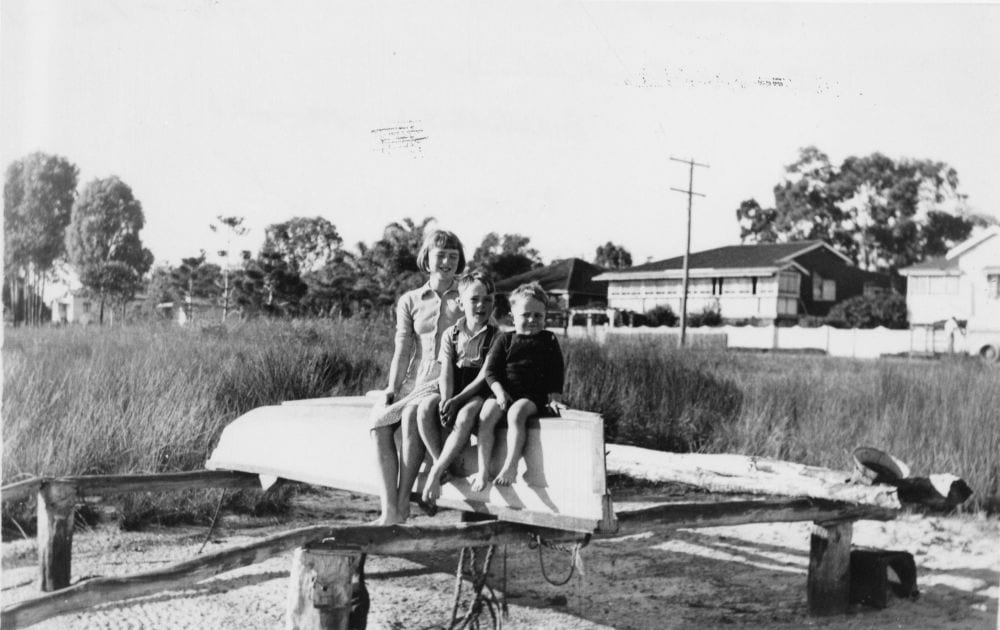
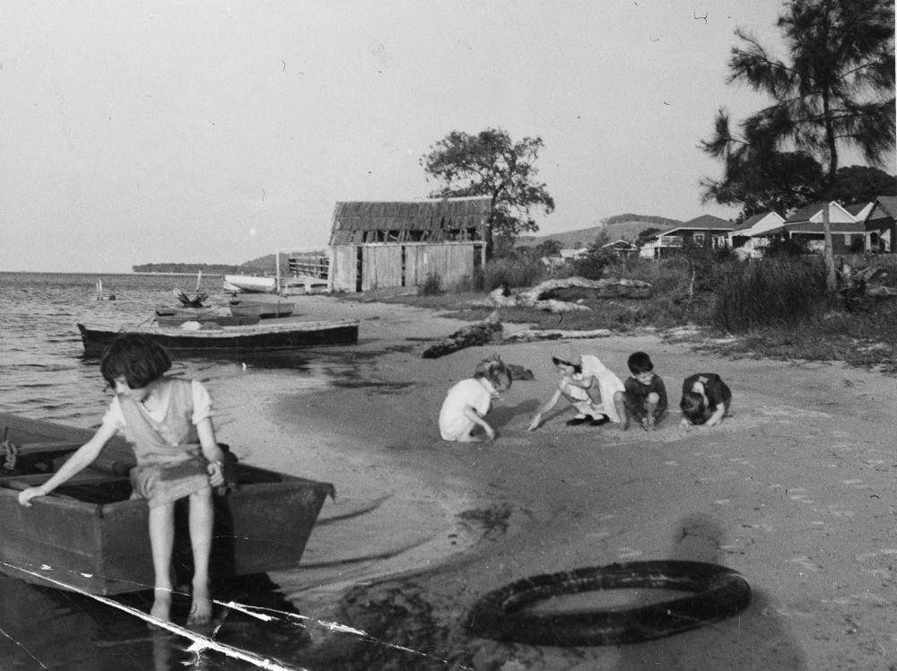
Children sitting on a dinghy along Gympie Terrace, 1952. Image courtesy of State Library of Queensland
First Australians made this land home tens of thousands of years ago and the first watercraft to traverse the Noosa River and the lakes were those made from the local trees by the Kabi Kabi nation. The Noosa River and the surrounding country belonged to countless generations of the Kabi Kabi. The estuary was full of fish and oysters, and the land was rich with casuarina, ash, gums, mahogany, honeysuckle, bloodwood, stringy bark, tea tree, scrub tree and box tree.
The late 19th Century
Gympie Terrace was only readily accessible by boat for the first six decades of its existence and the Noosa River naturally features prominently in its early history. This isolation meant that Gympie Terrace developed slowly at the end of the 19th Century while the neighbouring port of Tewantin grew rapidly.
Colonial interest in the Noosa area began with timber in the early 1860s. Queensland had separated from New South Wales in 1859. At that time, the vast majority of its European population of 25,000 was living in or near Brisbane. But the separation saw a huge influx and spread of Queensland’s population with a ten-fold increase in the population over the next 25 years. Timber was needed to build houses for this expanding population but it was also sought after back in Britain. Timber work was, therefore, a ready source of employment and many of the early towns north of Brisbane began at a similar time and vein to those in Noosa. The wider area was called the Near North Coast for a century before deciding to change its name to the Sunshine Coast in 1958.
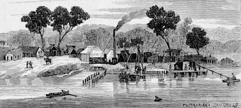
The lake scenery of Noosa, 1887, wood engraving by A.J. Boyd depicting Lake Cootharaba. Image courtesy of State Library of Victoria
Huge volumes of timber were removed from Noosa, including the highly sought-after red cedar. In 1866, a schooner named Independence delivered 20,000 feet (6000 metres) of red cedar logs from the Noosa River to Brisbane after a stuttered start due to some difficulties with weather, navigation and communication. Later that year, the Gneering shipped 30,000 feet (9100 metres). Timber remained the main industry for the next few decades in Noosa, with red cedar being Queensland’s largest export up to the turn of the century.
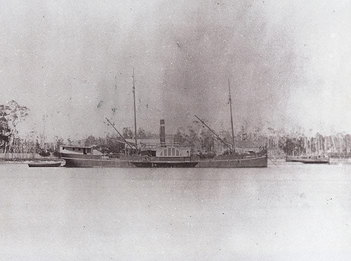
A paddlesteamer, Adonis, on Lake Cootharaba, 1860s
In 1867, gold was discovered at Gympie. The effect on Queensland was significant and immediate. Queensland had been in economic trouble and it was hoped that the discovery of gold relatively close to the capital city would be its saviour. A rough road running from Brisbane to Gympie began to be constructed and was ready for traffic the following year. Cobb & Co. ran two weekly coach services between the mining town and Brisbane. In 1868 the town of Tewantin was planned as a port was required for the growing timber industry. The first 2-acre wharf site was purchased by the miller William Pettigrew on a 5-year lease for £2 (about $2000 today). Several others soon followed, although it was another couple of years before land in the planned town was made available. In 1869, the Port Master of Queensland surveyed the Noosa estuary and reported it to be a better outlet for transporting timber than either the Mary River to the north or the Maroochy River to the south. A flourishing sawmill was established on Lake Cootharaba the same year.
A track from Gympie to the Noosa River via Cooran was cut by the settler Walter Hay in 1870. This allowed an easier and faster route to and from Brisbane rather than using the Mary River or the tortuous Brisbane Road. Land in Tewantin was finally made available at the beginning of 1871 and the township soon began to grow as a port for timber and providing supplies for both locals and Gympie residents, with multiple wharves constructed on the riverbank.
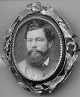
Brooch with a photo of Walter Hay, mounted circa1860s
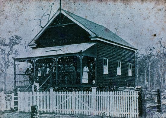
Land along the riverbank that became Gympie Terrace was purchased in 1871 shortly after Tewantin began to be built. The first piece of land to sell was 80 acres on the banks of Doonella Lake directly opposite Tewantin. It was bought by the miller, Frederick Goodchap. Walter Hay soon followed with several large purchases next to Goodchap’s land. He built a house on the property he named Hilton Park, from which the street, Hilton Terrace, later received its name. The house was a cottage of three bedrooms and verandah, with an outhouse for servants, a slaughterhouse, stock yards, a garden, and a crop of maize.
By 1872 a weekly mail service had been established between Gympie and Tewantin and Joe Keyser was transporting fish overland from Lake Weyba to sell for a good price in the booming mining town.
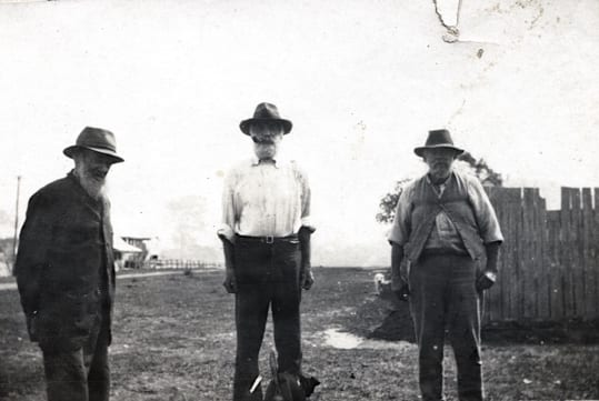
G.F. Ross, Joe Keyser & Edwin Hawkney, circa 1910
An Aboriginal Reserve was declared in 1872, covering much of what is Noosaville, Noosa Heads, Sunshine Beach, Peregian and west to Doonan. Such reserves were designed to separate the Indigenous and European populations and were created under the pretence that they would shelter the First Australians from frontier violence until they died out, which was expected to happen quickly. However, the value of the land in Noosa was soon recognised and in 1878 the reserve was cancelled. In 1887, the remaining Kabi Kabi in the area were forced to move to the reserve at Barambah (now Cherbourg), where they were forbidden to speak their own language or engage in their own culture.
By 1875 both Tewantin and Cootharaba were flourishing with two hotels in Tewantin and another on Noosa Road near Cooran Mountain, a regular coach service between Gympie and Tewantin, and speedy communication with the whole world via the telegraph. In Tewantin there were stores, a school, a boarding house, and a police station. Cootharaba also had a school, a store, a butcher, a carpenter’s shop, and a blacksmith. And they celebrated an annual regatta and dance on Lake Cootharaba on the Queen’s Birthday.
A detailed survey of the Noosa River from the bar at the mouth up to Tewantin was completed in 1876 by Staff Commander E.P. Bedwell. He reported that the bar and sand heads were constantly changing and that the whole estuary was a maze of sand banks. This accounted for some shipping mishaps that had already occurred and foretold future troubles.
The Noosa River had already become a holiday destination for some residents of Gympie, Eumundi and even further afield. By 1878 the coachman, George Paige Matters, had built a 3 x 3.5 metre cottage on his land south of Weyba Creek. He resided there three nights a week, with the other half of the time in Gympie at the other end of the carriage route. His family also used it as a holiday home for two months each year. Noosaville was already a holiday destination.
The Ely family settled on what would soon be called Gympie Terrace in 1883. They purchased a large selection of land bordered by what became Thomas Street, Edward Street, and Mary Street, and built a large home that would house their three sons, two of whom were born in the home. The Ely family would later run a cake shop on Gympie Terrace, were long associated with boat hire on the river, and remain connected with Noosaville today.
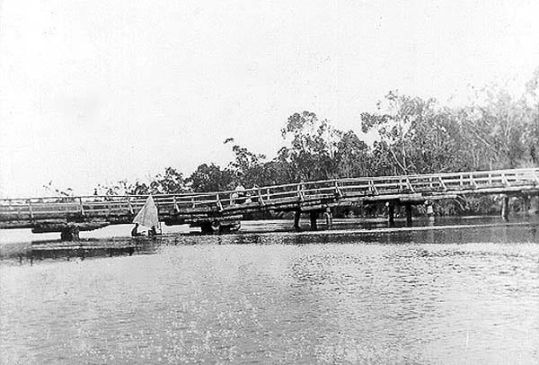
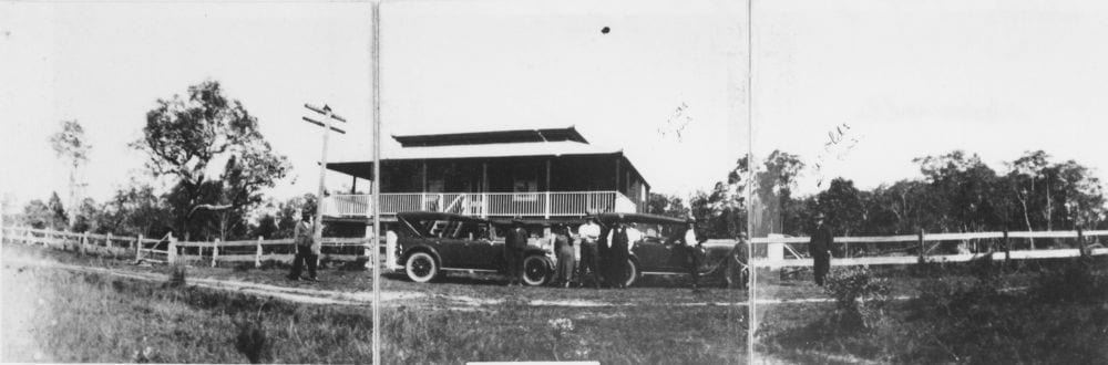
The Alexandra Bridge, circa 1900
The Alexandra Bridge (named after the Princess of Wales), a 61-metre wooden structure, was built over Weyba Creek in 1885-86. It was to provide access from Gympie Terrace to the village at Noosa Heads that had recently begun to grow with the erection of Walter Hay’s boarding house, Bay View House. The building of the bridge was only possible due to a colonial Government loan of £1,000 (roughly $800,000 today). But by 1901 it had been condemned as unsafe, then further damaged by bushfires and dismantled.
In 1888, the Gibson family made their house at Gympie Terrace their permanent home. They had previously used it as their holiday home for several years while William Gibson worked as a stonemason in Gympie. Gibson Road was later named after this family.
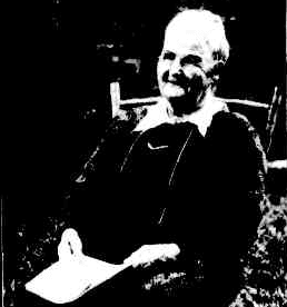
Elizabeth Gibson, 1932. Image courtesy of Queenslander
On 10th June 1889, the single railway line from Gympie to Cooran was opened. Meanwhile, down south, the railway from Brisbane to Caboolture had opened in 1888 and the construction was continuing north towards the golden town of Gympie. The final section from Yandina to Cooran was finished and the complete railway line was officially opened on 18th July 1891. This mode of transport was immediately popular for both passengers and goods to and from the Noosa area and it would have a long and lasting effect on Gympie Terrace. For the next 50 years, the majority of people travelling to Gympie Terrace travelled by train to Cooroy first. In 1891, the journey from Brisbane to Cooroy took 12 hours followed by a further 90 minutes in a horse-drawn carriage to Tewantin. But to get to Gympie Terrace one still had to travel by boat for the final leg. Jack Tedfords offered a service with his ferry, The Emerald. The locals had their own boats.
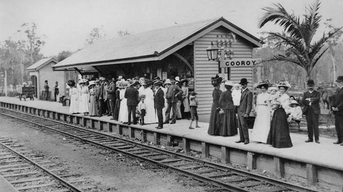
Cooroy Railway Station, circa 1910
The railway line was positive for Queensland and for the hinterland of the Noosa area but it initially had a drastic negative effect on the port town of Tewantin. At the beginning of the 1890s, the Australian economy suffered a depression, along with much of the world. Demand for timber waned and sawmills closed. This, and the fact that all of the good softwood had already been felled around Noosa, and the impact of the completion of the railway between Brisbane and Gympie, had a significant depressing effect on Tewantin and the other offshoots on the Noosa River, including Gympie Terrace. By the end of the decade Tewantin’s wharves and warehouses were largely abandoned and in decay.
One of the worst floods recorded to hit the area (and all the way past Brisbane) occurred at the start of March in 1893. After nine days of heavy rain, Lake Cootharaba rose by two metres. Some homes on the Noosa River were washed away. The remains of the Cootharaba sawmill were destroyed. The few houses along Gympie Terrace were isolated by water. It was found to be knee-deep under Frederick Goodchap’s house by a relief party. The Goodchaps were given board at the Royal Mail Hotel in Tewantin, despite being fully occupied with visitors already.
In 1896 Dick Parkyn built the home called Miner’s Rest on Gympie Terrace. The Parkyn family would later build a shop and holiday flats at Munna Point and were synonymous with boating, fishing and prawning on the Noosa River and Laguna Bay.
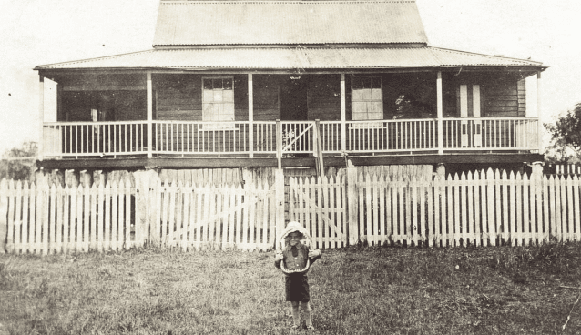
Howard Parkyn holding shark jaws in front of his grandfather’s house, Miner’s Rest, 1917
The early 20th Century
Gympie Terrace continued to slowly draw people from the goldmining town of Gympie at the beginning of the 20th Century. The river remained a prominent part of everyone’s lives, with the abundant fish a source of both food and income.
In 1902 or 1903 the director of the Scottish Gold Mines Company in Gympie transported a large house to the corner of Gympie Terrace and Thomas Street on the back of bullock drays. It was named Kilkivan after the town that David Elder Reid had first migrated to from Scotland in 1885. Reid had recently returned from the Boer War in South Africa, serving as Brigade Major of the 5th Light Horse. In 1903, he married Ann Jannett Murray and was elected Mayor of Gympie. He continued to holiday on Gympie Terrace until his death in 1930.
By 1904 Frederick Joseph Kearton, an engineer from Gympie, and his family had settled in their residence on the esplanade. By now the name ‘Gympie Terrace’ was well established. Also around this time Tommy Williams began living at Munna Point with his steam-boat, Maggie.
An aquatic sports day was held on Doonella Lake in 1907. It is highly likely that residents of Gympie Terrace participated or at least observed the event. In later years, many such events would be enjoyed on the Noosa River right in front of Gympie Terrace.
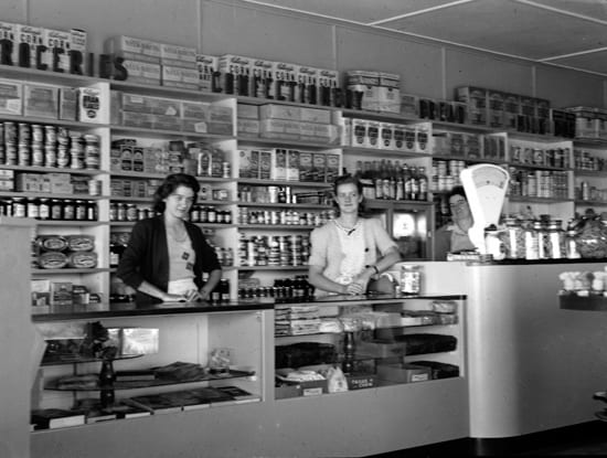
A Lebanese family, the Massouds, moved to Gympie Terrace in 1908, buying the Ely family’s home after the death of John Ely. Predictably, they had moved down from Gympie where Ted, later known to all as ‘Jiddy’, had worked in the goldmines for a few years after migrating to Australia from the Ottoman Empire. The Massouds were soon synonymous with both Gympie Terrace and the Noosa River, and the family remains closely tied to the neighbourhood today. Jiddy and Sitty established the first shop on Gympie Terrace, selling groceries to the slowly increasing number of residents and to day-trippers and campers who were beginning to enjoy the delights of the Noosa River, especially at Easter and Christmastime. They supplemented the shop with fishing, at first catching bream at night with fishing lines but soon employing a crew and catching mullet with nets.
It is said that there were just 13 houses at Gympie Terrace at the time, with about 30 people in residence.
With a population of approximately 2000, the Shire of Noosa was created in 1910. This separated them from the dominance of Gympie, having previously been under administration of the Widgee Shire. Gympie Terrace was represented by an elected official from Tewantin at this time. Pomona was elected to be the Shire’s centre, with the Council office opening in 1911.
Noosa Shire Chambers, circa 1910
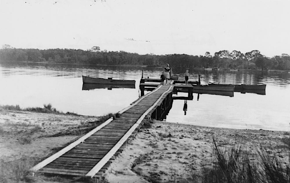
The children of Gympie Terrace attended primary school in Tewantin. There was no high school. The only means of travelling to school in Tewantin was by boat. Olive Freeman, great-granddaughter of Walter Hay, would row from Noosa Heads in a dinghy, picking up the Massoud children on the way. When Bill Massoud got older, he took over the oars, sometimes stopping at Goat Island for his brothers to pick berries. Sometimes they stayed for longer than they should and Olive would abandon the boys on the island and continue the voyage to school without them.
Arthur Finney’s launch of an ice works and cold storage chamber in Tewantin was celebrated in December 1912 with champagne at Tait’s Royal Mail Hotel. The ability to create ice had an enormous effect on the move towards professional fishing, especially after Alex Gibson took over the ice works and installed a 9-horsepower Hornsby engine in 1917.
At this time, there were only six small bridges and less than one kilometre of gravelled road within the shire. Horse-drawn carriages still transported people from the railway line to the river but most of the sparse traffic were bullock teams that followed old tracks through the scrub and forest. The Council understood the need for improved roads for residents and visitors alike. They acquired two loans of £2,000 (over $500,000 today) to create and improve roads. The Council would shortly partner with neighbouring shires to lobby the State Government to construct a ‘Great Northern Road’. This would eventuate in the 1930s with the construction of the Bruce Highway but in the meantime the world was interrupted by the First World War.
The news of war in Europe was embraced patriotically by Australia, and enthusiastically by some. Many believed that the Great War would be over quickly with Britain victorious. Thirteen men from the Noosa Shire enlisted within weeks of the war being declared, and a further 26 by the end of 1914. Life along the isolated riverbank continued on nevertheless.
Ned Ely, a fisherman, married Annie Durham around 1915. Moving to Ned’s home in Gympie Terrace, Annie began baking cakes and pies and selling them door-to-door. She was also employed as the cook at Laguna House at Noosa Heads during the war. She would later set up a shop on Gympie Terrace, helped out by their son, Len.
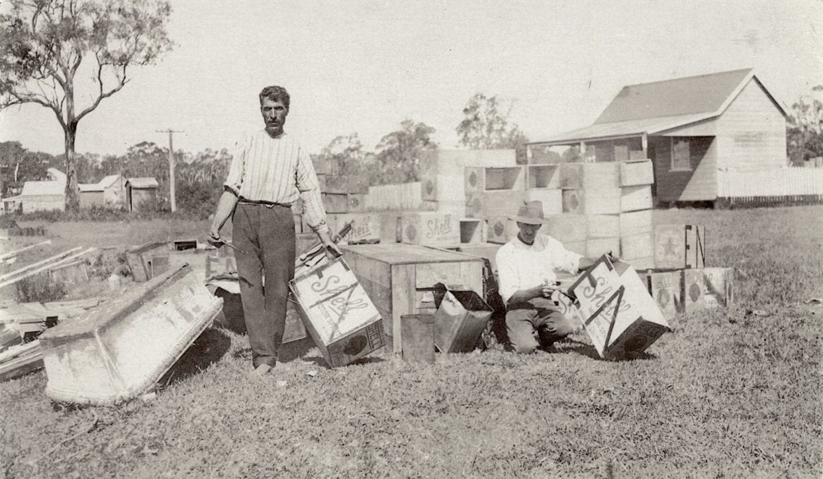
Jiddy Massoud and Nicholas Kross reusing empty boxes, circa 1930
Jiddy Massoud bought a boat, Riverlight, in 1915. The vessel was used for multiple purposes, including fishing and transporting the family upon the river, but Jiddy also delivered the mail to Gympie Terrace and Noosa Heads three times a week. He soon secured a contract with the Education Department to transport the children to school in Tewantin. At the age of just 12, George Massoud became the skipper, responsible for the student transport.
A tramway from Eumundi to either Tewantin or Gympie Terrace was seriously considered in 1915 but the idea never eventuated.
The Great War continued for four years and its effects were increasingly felt on the homefront. The people of Noosa were incredible in their support with endless fundraising and sending of goods to their family members and unknown soldiers alike. By the end of the war more than 400 men had enlisted from Noosa Shire, including George Burgess of Gympie Terrace. Sadly, 99 soldiers from Noosa would not return, either killed in action or dying of wounds or illness whilst serving.
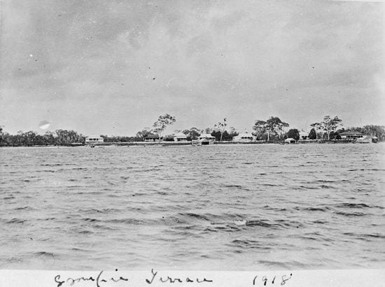
Gympie Terrace viewed from the north shore, circa 1918
When news of the war ending reached the banks of the Noosa River late in the evening of 11th November 1918, jubilation erupted spontaneously with cheering, dancing, and tumultuous singing accompanied by bells, tin cans and anything that could make a noise. The next day, sports and a picnic were held for the children in the afternoon, with dancing, singing and games in the evening for the adults. A peace demonstration and torchlight procession was planned for the following weekend.
In July 1919, after the signing of the official peace treaty with Germany, the Treaty of Versailles, Noosa celebrated with a peace flotilla on the River. This included a number of boats with the crews dressed up and flying the flags of the victorious allied nations. From Gympie Terrace, Alexander Gibson’s boat represented Belgium and Frederick Kearton’s boat represented Serbia.
Peace Flotilla upon the Noosa River, July, 1919
Sanitation was an increasingly pressing problem for the Council, especially in the town Tewantin but also along Gympie Terrace and at Noosa Heads. During the holiday periods of Easter and Christmas they were witnessing increasing numbers of visitors and campers each year and the primitive facilities that existed could not cope.
The 1920s
In the happy, flourishing, post-war years of the 1920s, Gympie Terrace welcomed a steady increase of residents to its neighbourhood and a significant increase of visitors and camping holidaymakers.
According to a progress association meeting decades later, the suburb called Noosaville received this name in the early 1920s. But ‘Gympie Terrace’ remained the popular term for the whole neighbourhood until after the Second World War.
Access to the Noosa River and Gympie Terrace was becoming easier with the rise of the automobile. Cars were still quite rare in Australia at the beginning of the 1920s but by the end of the decade there were more than half a million in the country. The increase in fast, flexible, individual travel would see an increase in tourism, especially weekend trips. This was certainly the case for Gympie Terrace but roads of an appropriate grade to accommodate cars were required. Work on a Main Road between Cooroy and Tewantin began construction in 1922 although it was not completed until the end of 1928.
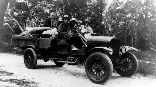
Spinaze and Menisforth families travelling towards the Noosa River from Pomona, circa 1928
Numerous newspaper articles appeared during the 1920s relaying the magnificence of the Noosa River and its settlements for people to visit, including the quaintness of the red roofs of Gympie Terrace in contrast to the green bush of its surrounds. Such tales increased tourism further.
Jiddy Massoud constructed a slipway on the bank of Gympie Terrace in 1923, followed by a jetty in 1927. They remain on the bank of Gympie Terrace today.
Jack, Howard & Daisy Parkyn aboard Miss Tewantin, late 1920s
Jack and Daisy Parkyn returned to Gympie Terrace from Gympie in 1925 and bought the 60-passenger launch, Miss Tewantin. Primarily it was used for shipping people from Tewantin to Gympie Terrace or Noosa Heads and back but it was also used for tourist trips to the lakes and the coloured sands via Teewah. It was also occasionally used to freight fish to Brisbane and bring back supplies, which included the materials for Jack to build a house and shop at Munna Point. Later, the Parkyns took over the Massouds’ contract to transport school children to and from Tewantin. There were 46 children residing at Gympie Terrace by 1930.
Jack & Daisy Parkyn and family in front of their home, the first built at Munna Point, 1925
The creation of Hilton Esplanade, right on the bank of the river, was approved by Council in 1925.
In 1926, it appeared that there were new buildings going up everywhere. The number of houses in Gympie Terrace more than doubled between the end of the war and the end of the 1920s, with several subdivisions around Elizabeth Street. Road works were completed on Gympie Terrace itself with forming and corduroying (road construction using tree trunks). A public meeting proposed building a bridge over Lake Doonella. Its estimated cost was £5000 (about $1,500,000 today). Other issues reported during the year included a problem with mosquitoes breeding in the water tanks, and the Council employing a contractor to move the public (non-flushing) toilets to a more suitable place for the cost of £1 (about $300 today). The Noosa Shire Council also discussed providing electricity to Cooran, Pomona and Cooroy but it was deemed too expensive at this time.
The Olds’ residence on Gympie Terrace, circa 1925. Image courtesy of State Library of Queensland
In 1927, open season was declared on hunting koalas in the shire. As a consequence, most of them were slaughtered within a few years although some locals, such as the Monks family at Lake Weyba, continued to feed them in the 1930s. (The current koala population at Noosa National Park was introduced from Caboolture in the 1960s).
After a slow increase in population during its first decade, the Noosa Shire population reached 4413 in 1927. Visitor numbers were increasing steadily also. The residents of Eumundi proposed building a road directly to Gympie Terrace and Tewantin in order to remove the 6 miles (9 kilometres) of having to pass through Cooroy on the Main Road that was nearing completion. There were many tents pitched at Gympie Terrace at Christmas.
In 1928, the Post and Telegraph Department decided to establish an allowance post office at Gympie Terrace, servicing not just the residents but the large numbers of holidaying visitors. A bullock wagon damaged the surface of Gympie Terrace significantly during the year. In December, the Cooroy-Tewantin Road was declared officially open. Two months later the coastal communities were pounded by a cyclone that saw waves breaking over Munna Point.
The Council’s plans to connect Gympie Terrace and Noosa Heads to Tewantin by building bridges over Lake Doonella and Weyba Creek were moving forward. They had negotiated with T.M. Burke & Co. to fund the construction by selling the company several hundred acres at what is now Sunshine Beach (then confusingly called ‘Coolum Beach’) for £12,500 (around $3,500,000). The company would then receive the majority of this money back by building the pile bridges. The surface of Gympie Terrace was gravelled in anticipation of the traffic.
Motorists waiting for the opening of the Doonella Bridge, 19th October 1929
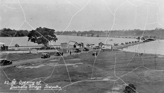
Motorists crossing the Doonella Bridge towards Gympie Terrace, 19th October 1929
Both bridges were officially opened on 19th October 1929 by the Home Secretary, J.C. Peterson . It is reported that some 700 cars were in attendance, waiting to cross, and that 4000 people gathered at Noosa Heads beach later that day. A 12 year-old, Laurie Lennox, rode the first horse over Doonella Bridge as part of the opening, recalling in later years that he was scolded by his father for cantering instead of walking. Lionel Donovan, of Laguna House at Noosa Heads, claimed to have driven the first car across by sneaking under the chain prior to the official opening.
The 1930s
The Great Depression was an overarching feature throughout the Western world at the beginning of the 1930s. But tourism to Gympie Terrace continued to increase now that it was connected by bridges to Tewantin and Noosa Heads.
The opening of the bridges brought more residents and visitors to Gympie Terrace as well as a lot of traffic passing through. It also brought motor vehicle accidents, though most of these were minor. Boating traffic increased also, with Jack Olds requesting permission to erect another jetty along Gympie Terrace in 1930.
Gympie Terrace, circa 1930
Shortly after school re-opened in 1930 following the Christmas holidays, a meeting was held between several residents and their member of parliament, H.F. Walker. The locals pointed out that although the newly constructed bridges connected them to Tewantin, their children should not be expected to walk up to 2.5 miles (4 kilometres) each way to school and back. They suggested that if the previous subsidy for transporting the students by boat to school was no longer available, that they would request the establishment of a school at Gympie Terrace.
The increase of motor traffic impacted the surface of Gympie Terrace straight away. The Gympie Terrace Improvement Society reported the terrible state of the road as early as May 1930 and continued to remind the Council until it was addressed.
Sunday Mail, 10th January 1932
Nambour Chronicle, 2nd October, 1931
Complaints were received by the Council in early 1931 regarding the lack of water and conveniences at the camping sites on Gympie Terrace despite being charged 5 shillings (about $50) to camp.
In February, the river flooded and surrounded the houses along Gympie Terrace. Only the highest point of the Doonella Bridge was visible above the swell. But naturally the water soon abated and progress continued. Jack Parkyn was given approval to build a garage and laundry at Munna Point. And the plans for Arthur Wallace’s residence on the hill previously owned by Walter Hay were approved. This building, now known as Wallace House, remains in situ today in Wallace Park.
The Parkyn Store, Munna Point, early 1930s
Sanitary work was carried out at the Lake Doonella end of Gympie Terrace.
The Great Depression that hit the world’s economies in 1929 continued well into the 1930s. Its effects were perhaps less severe on the Noosa River than elsewhere, with fresh fish a readily available source of free food. But it was still noticeable. The State Government had provided extra employment opportunities by increasing road works. In early 1931 this included work in Tewantin, Gympie Terrace and Noosa Heads by visiting labourers.
The need for a “sanitary convenience” (toilet) near the ladies’ bathing shed at Gympie Terrace was raised in 1932.
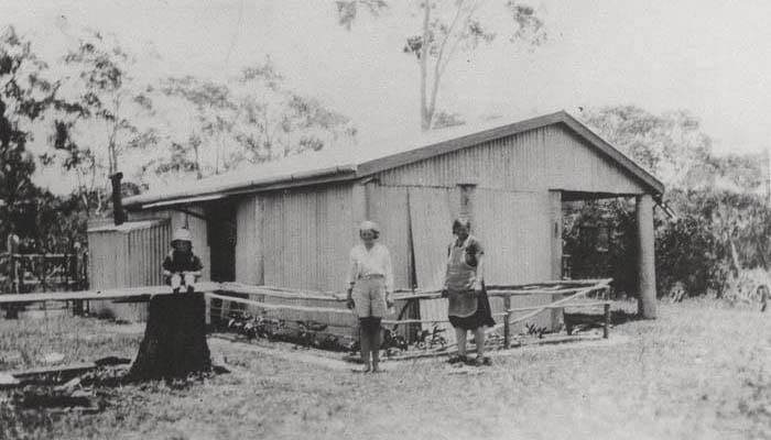
The Menisforth family’s holiday hut, circa 1932
Possibly the first marriage held on the banks of the Noosa River at Gympie Terrace was that between Florence Ferguson and George Derwent, on 28th January 1932. Florence had grown up on Gympie Terrace, the youngest daughter of William and Mrs Ferguson, one of the neighbourhood’s first families. They were married by Reverend C.E. Paull.
Brisbane Courier, 6 July, 1932
The Gympie Terrace Progress Association held a fundraising dance in Cardell Hall in April. The music was provided by the Joy Boys Orchestra of Cootharaba and the night raised £7 (around $1000 today).
By 1933, there were about 60 houses and shops at Gympie Terrace.
Central Queensland Herald, 11th May, 1933
In April, Jean Dunstan (nee Wallace) was visiting her parents with her husband, Frank, and their two young family. Frank took the two young sons fishing. Tragically the youngest, Richard, aged 3, fell overboard and both he and his father drowned. Jean remained in Noosaville with her young family, living with her parents until they passed away decades later.
Later in 1933, the Council began taking steps to prevent further erosion of the riverbank along Gympie Terrace and Munna Point. They also began to clear undergrowth behind Gympie Terrace in preparation of its sale. The back road (now Gibson Road) was also reconditioned to relieve congestion on the main road during the peak holiday times.
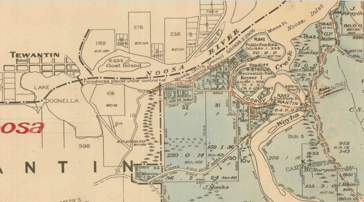
1944 map featuring Noosaville. Image courtesy of Queensland Historical Atlas
In October, the Maroochydore District Brass Band visited Gympie Terrace and Tewantin, where they performed at a dance at Cardell’s Hall and raised £6 (around $1000). Possibly prompted by this successful event, the Gympie Terrace Progress Association announced plans to build a hall on Gympie Terrace, partially overlapping the river. The brass band announced their intention to return at Christmas. Unfortunately for them, having pitched their tents, it flooded on Christmas Day. Even going home was difficult due to the flooded roads. Continuous rain through January caused further damage to the dirt roads and, combined with big tides, caused further erosion at Munna Point.
A case at the Pomona Summons Court in February 1934 involved Gympie Terrace residents Bill Massoud and Nick Kross. The previous year, Kross was delivering goods to the lighthouse keepers at Double Island Point when his truck broke down. He returned to discover his truck had been damaged. Presumably, for reasons unknown, he blamed Massoud. Kross was found guilty of assault and fined £5 (nearly $1000 today), as well as guilty of using indecent language and fined a further £1 (about $200) plus costs.
Just months later, Bill Massoud was lucky to avoid more serious injury. An aeroplane made an emergency landing on the North Shore Beach in April 1934. A fierce storm on Easter Sunday damaged the Western Star, owned by Rockhampton Aerial Services. The plane had to be partly dismantled so that it could be shipped to Gympie Terrace aboard Massoud’s big motor launch. However, when it was being unloaded, the plane fell into the river and narrowly missed hitting Massoud, who dived into the water to escape the impact. The pieces of the plane were soon brought onto land and eventually loaded onto trucks that carried them to Cooroy, and were then returned to Rockhampton by train.
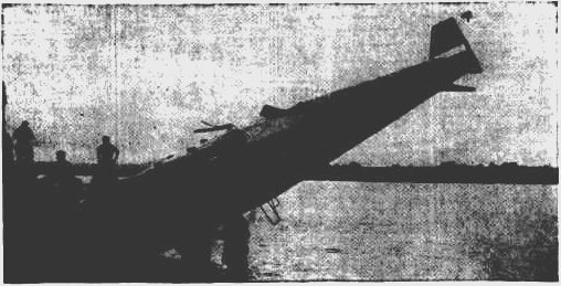
The Western Star being hauled onto the banks of Gympie Terrace. Image courtesy of Morning Bulletin
Pig and Sheep Islands were declared wildlife sanctuaries in 1934 in response to public demand to protect their birdlife. This is perhaps the earliest example of concern for the conservation of the natural environment in Noosa, which remains a fundamental part of Noosaville’s culture today.
The Gympie Terrace Progress Association held a social evening in September, in Edgar Bennett’s shop. A dance was held and cards were played.
Nambour Chronicle, 28th September, 1934
Motor traffic continued to increase. In December 1934, the first section of the Bruce Highway was opened between Brisbane and Landsborough. Its construction would continue north, making it much easier for people to travel to Noosa Shire. Record numbers of campers arrived at Gympie Terrace, Munna Point and Tewantin for the Christmas holidays (although most of them still arrived by train to Cooroy at this stage). Once again there were complaints about the lack of facilities: water, toilets and dressing sheds for both sexes. In response, Councillor Read noted that on one Sunday alone, 1027 motor vehicles went through Gympie Terrace. Furthermore, the poor condition of the bathing sheds was blamed largely on the holiday-makers themselves, as was the lack of water due to people letting the taps run. Nevertheless, it was agreed to address the requirements prior to Easter.
Camping at Munna Point, 1930s
Daily Standard, 11th February 1935
In April 1935, Post and Telegraph Department workers completed installing telephone wires underground between Tewantin and Gympie Terrace, ensuring a more reliable service. Later that year an electric company announced its interest providing power to the community. But this would not occur for another 12 years.
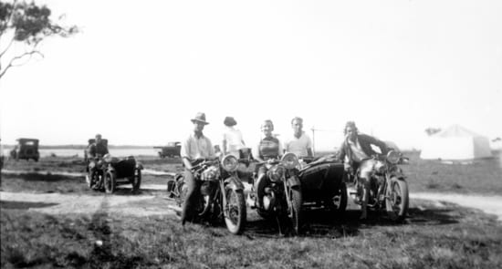
Motorbikes at Munna Point, 1930s
Camping grounds and holiday houses for hire were once again filled to capacity at Easter.
A social evening was held in Mrs M. Ely’s café on Gympie Terrace in August 1935 in support of Miss Audrey Read, the Tewantin and district representative in the “Queen” competition of the Noosa parish of the Church of England. Like other social events of the day, it consisted of dancing and cards – a euchre match.
Gympie Terrace, 1935. Image courtesy of State Library of Queensland
Gympie Terrace, 1935. Image courtesy of Sunshine Coast Libraries
From 1934 through to 1936 the Gympie Terrace Progress Association worked towards their plans of a 40 x 60-foot (12 x 18 metres) hall in a central position along Gympie Terrace, overlapping the river slightly. They raised considerable funds for the project and gained Council support but failed to get permission from the Marine Board and Main Roads Commission. In November 1936, they decided to redirect the £100 raised (about $9000 today) towards constructing public baths on the river. The following year Jiddy and Sitty Massoud made tentative plans for another public hall but these did not eventuate either.
Jiddy & Sitty Massoud, 1930s
It was not until 1936 that a regular, coordinated service offering motor transport from Cooroy railway station to the settlements on the Noosa River was offered by Lionel Donovan and his fleet of cars. The Mayfair movie theatre opened in Tewantin and free buses would carry the residents of Gympie Terrace and Noosa Heads into Tewantin to attend the cinema on Saturday evenings.
Donovan’s railway-taxi service outside the Parkyn Store, Munna Point, late 1930s
Numerous houses were being built in 1937, including a number of cottages by L.T. Elmer between the Doonella Bridge and Gympie Terrace.
The Gympie Terrace Progress Association asked the Council to make a representation to the Main Roads Commission to construct a bitumen surface along Gympie Terrace. Council was informed that it could not occur at this time as all available funds were being used to improve the road from Cooroy to Tewantin.
The public jetties were reconditioned by Council workers in September.
In December, the Tewantin-Noosa Progress Association asked the Council to impress upon the residents of Gympie Terrace that the esplanade in front of their premises did not belong to them and recommended that notices prohibiting the destruction of trees along the banks be posted. The Council agreed. The camping sites and holiday cottages were full to capacity over the Christmas holidays once again.
The Telegraph, 7th December, 1937
The Telegraph, 1st January, 1938
The building boom continued through 1938 and the local sawmills were hard pressed to keep up with the demand for timber.
The Post and Telegraph Department began providing cash-on-delivery parcel facilities for Noosaville in March, as well as providing facilities to sell postage stamps, and establishing letter boxes for Gympie Terrace and Munna Point.
A butcher’s shop was erected at Gympie Terrace by Bill Ross, a World War I veteran, in April.
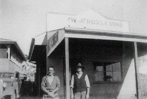
Bill Ross (left), outside his butchery on Gympie Terrace, date unknown
Council received plans and specifications for the construction of 10,000 feet (about 3 kilometres) of the Tewantin-Gympie Terrace main road at a cost of £5339 9s 3d (roughly $750,000 today). Earthworks began in October with 39 men, 5 trucks and a power grader completing the work before bitumen and tar-surfacing began in November and was completed by Christmas.
View of the Noosa River and Massoud’s Jetty on Gympie Terrace, circa early 1940s
In December, the Tewantin Playground Committee erected three sets of swings along Gympie Terrace and Munna Point (as well as a slide near the Memorial Baths in Tewantin).
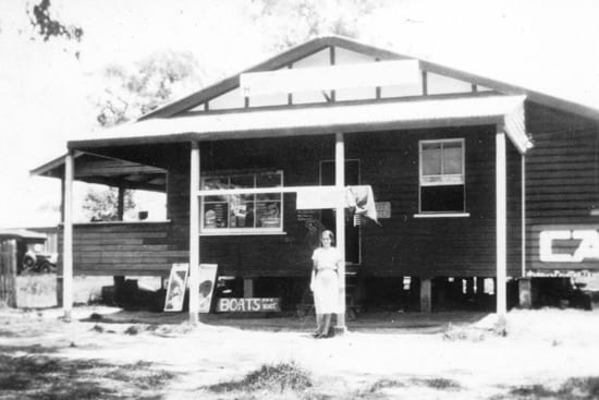
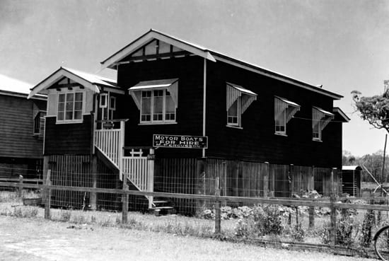
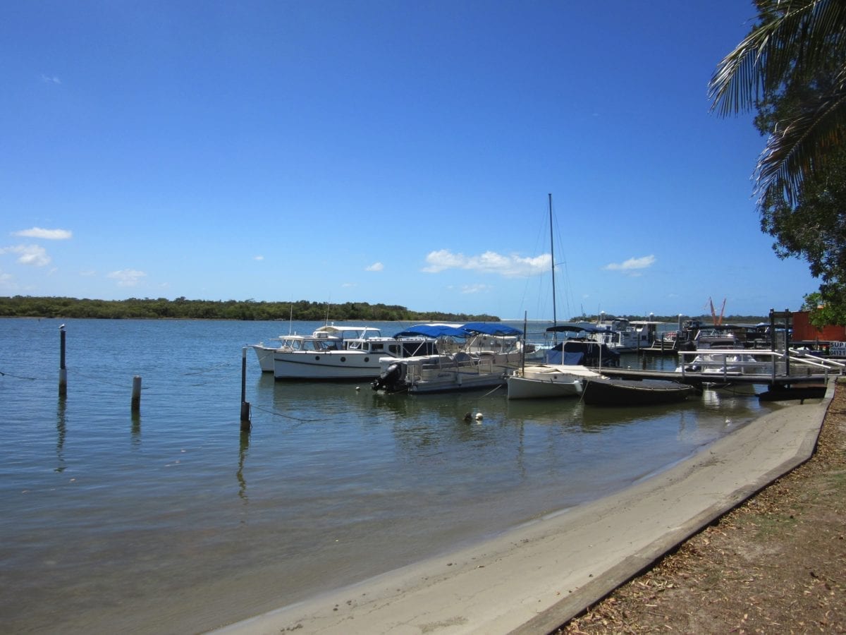
One of the first boat hire businesses on the river, Terrace Boat Hire, was begun by Tom and Audrey Salta in 1938, opposite their grocery shop, Terrace Stores, on the corner of Gympie Terrace and Weyba Road. It remains operational, under different ownership, as T Boat Hire today.
The cleaning charge per pan per service for the removal of ‘night soil’ at this time was 8 pence (about $6 today).
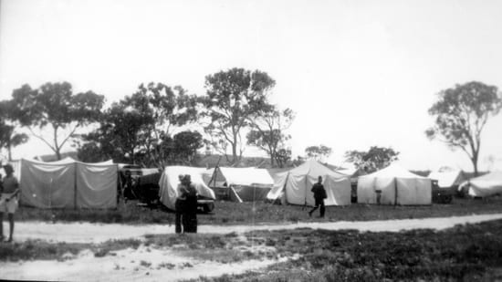
The wells and public water tanks were empty on 27th December 1938 and the Council was forced to cart water from Noosa Heads to supply the occupants of 125 tents along Gympie Terrace and a further 75 tents at Munna point. The dry conditions continued well into January with many of the residents running out of water also. In February 1939, Council agreed to test for more water supplies at Tewantin, Gympie Terrace and Munna Point.
Gympie Terrace, 1930s
In 1939 the original 600 acres of Noosa National Park was declared around the headland.
In March, Charles Johnson, was driving home to Gympie Terrace over Doonella Bridge from Tewantin when he ran into the guard rail trying to avoid a horse on the road. His car was damaged, he received bad lacerations to his arm, and his dog was hurled into the water.
Courier Mail, 22nd August, 1929
The 1940s & 1950s
The Second World War not only saw residents from Gympie Terrace serve in the armed forces but brought training troops and live practice artillery to the neighbourhood. After the war, the holidaymakers returned in ever increasing numbers and the professional fishing industry took off apace.
Following three motor vehicle incidents over the Christmas holidays, the Main Roads Commission was asked to install signs against speeding at each end of Gympie Terrace in early 1940.
Once again, sanitation and water supply were issues for campers over Christmas. Council agreed to install 5 bay lavatories at both Gympie Terrace and Munna Point and further facilities at the other camping sites. A water diviner was employed to find places to put down a bore for fresh water. Later in the year, Council agreed to address ongoing erosion issues along the esplanade.
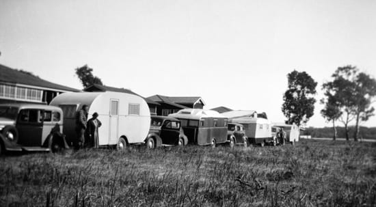
Caravans parked along Russell Street, Munna Point, early 1940s
The Second World War had erupted in Europe in September 1939. A soldier visiting his parents in Tewantin was fatally injured in a one-car accident on a corner between Gympie Terrace and Noosa Heads on Boxing Day 1940.
The ongoing issues with water supply for campers at Gympie Terrace was once again addressed in early 1941 with a recommendation to make the water supply fit for human consumption by cleaning out the well and finding a suitable timber for support that would not discolour the water. But it was not possible to replace the angle pieces and it was reported that the well would have to be re-sunk using the timber from the existing well.
In June 1941, the City Electric Light Company presented a plan to Council to provide street lights to Gympie Terrace along with the other main settlements in the shire.
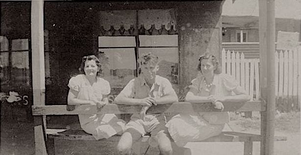
Maisie Massoud, Viv Ely, Kathie Massoud (nee Kross), circa early 1940s
Troops from the 2/14th Battalion arrived to train on the Noosa River and Lake Weyba in the winter of 1942. They had been serving in the Middle East and would soon be sent as reinforcements to the Kokoda Trail in Papua New Guinea. In the meantime, they were officially stationed at Yandina but spread out across the region from Caloundra to Mooloolaba to Coolum to Nambour to Eumundi, and to Munna Point. At Noosa, they were training in new amphibious vehicles called DUKWs, or ‘ducks’, under the command of Lieutenant Stanley Bisset. They were fed daily at Maisie’s by the Massoud family who cooked up to 200kg of fish each night. The Massouds would also roll their pianola out onto the street to entertain the soldiers. Bisset and Maisie remained life-long friends.
Worker, 16th January, 1943
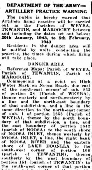
The following summer, the Department of Army Artillery used the Noosa area for artillery practice. It is possible that unexploded devices remain in the hills.
Nambour Chronicle, 10th December, 1943
Annie Ely’s second son, Vivian, was a Flying Officer serving with the Royal Australian Air Force during World War II. In April 1945, she received notice that he was missing following a mission over Germany. The war in Europe ended the following month. Sadly, Viv did not return.
In November 1945, Elizabeth Bennett, long-term resident of Gympie Terrace, died of tetanus after stepping on a nail. Her husband, Edgar, was elected as a Councillor the following year and again in 1949.
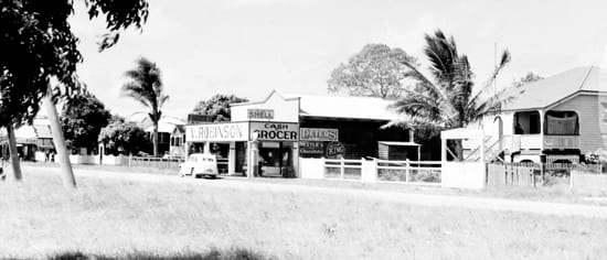
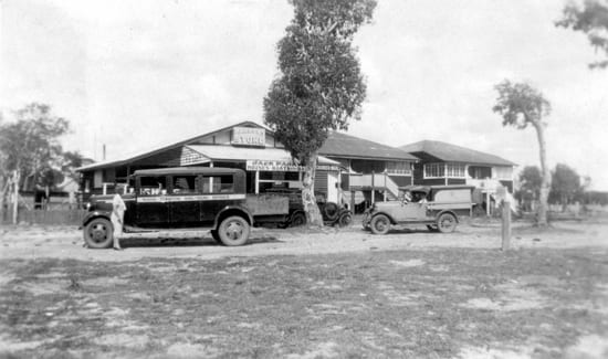
The Bennetts’ house (right) and Robinson’s Store, Gympie Terrace, circa 1940s
Fishing and boat hire were already important businesses in Noosa, including residents of Gympie Terrace, but in the decade after the Second World war they increased significantly, including a boom in the prawning industry.
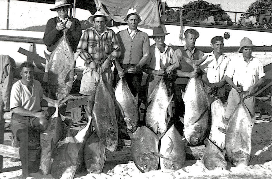
The Massoud crew, 1950s
Gympie Terrace was finally connected to the State’s electricity grid in 1947, along with Tewantin. Supply was extended to Noosa Heads shortly afterwards.
The Fergusons’ house, Canberra, 1947. Image courtesy of Sunshine Coast Libraries
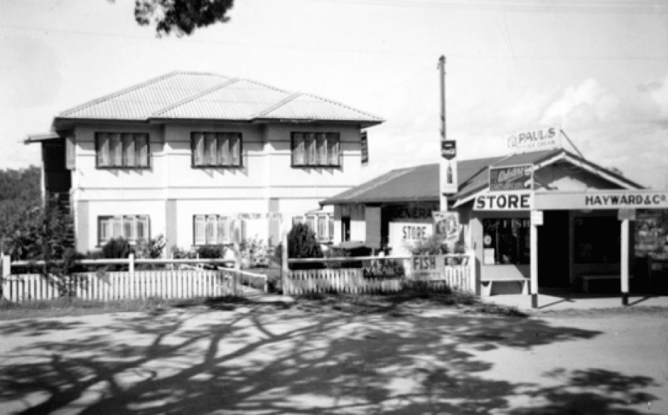
Carlton Flats and Hayward & Co. Store, Noosaville, late 1940s. Image courtesy of Sunshine Coast Libraries
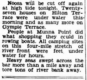
Storms hit Southeast Queensland in March 1948, with gigantic waves having a devastating effect at Noosa Heads. At high tide, 27 houses on Hilton Terrace were under water, plus many more along Gympie Terrace and at Munna Point. Residents reportedly shopped for supplies by boat. Large sections of the riverbank were washed away.
The Newcastle Sun, 25th March, 1948
Lionel Donovan, now owner of 4 motor buses, purchased a road grader to keep ‘Noosa Main Road’ in a trafficable condition with the Council’s permission, pending their appeals to the Main Roads Commission to build an improved road.
Gympie Terrace, circa 1948circa1860s
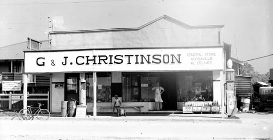
Christinson’s Store, Noosaville, 1949
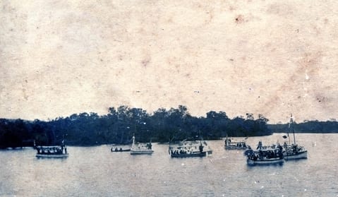
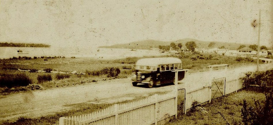
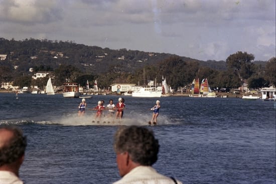
On New Year’s Day in 1949 an aquatic sports day was held on the Noosa River. In 1952 a power boat competition was held on New Year’s Day and this soon became an annual event, becoming the Festival of the Waters in the early 1960s. The celebration would sometimes last for days, beginning with a street parade along the length of Gympie Terrace.
Motor boat racing on the Noosa River, New Year’s Day 1952. Image courtesy of The Courier Mail
By 1949 the old Gympie Terrace Progress Association had merged with other groups to form the Tewantin-Noosa Progress Association, although it was noted that the meetings were territorial – when meetings were held in Tewantin, few members from Gympie Terrace or Noosa Heads would attend. In 1950, the association requested Council look into the matter of providing a pedestrian bridge across Lake Doonella as the increased motor traffic on the existing bridge was a menace to those on foot, especially during holidays.
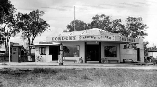
Condon’s Service Corner, Gympie Terrace & Thomas Street, 1949
Condon’s Service Corner, 1949. Image courtesy of Sunshine Coast Libraries
Sanitary issues due to the volume of tourists continued to be a nuisance at Gympie Terrace during the 1950s. Nevertheless, urban development continued to increase throughout the area. This including the surveying and sealing of Hastings Street at Noosa Heads, and the beginnings of land reclamation that would come to the fore in the 1970s, which further increased visitation to Gympie Terrace. There remained a paucity of bitumen roads in the shire, however, and most of the roads were in poor condition.
Sand mining was considered as a local industry at the beginning of the 1950s, including interest from the Massoud brothers. But persistent, vocal protest from many local residents ensured that permission was not forthcoming. Debate between development and environment would become more common and heated in the coming decades.
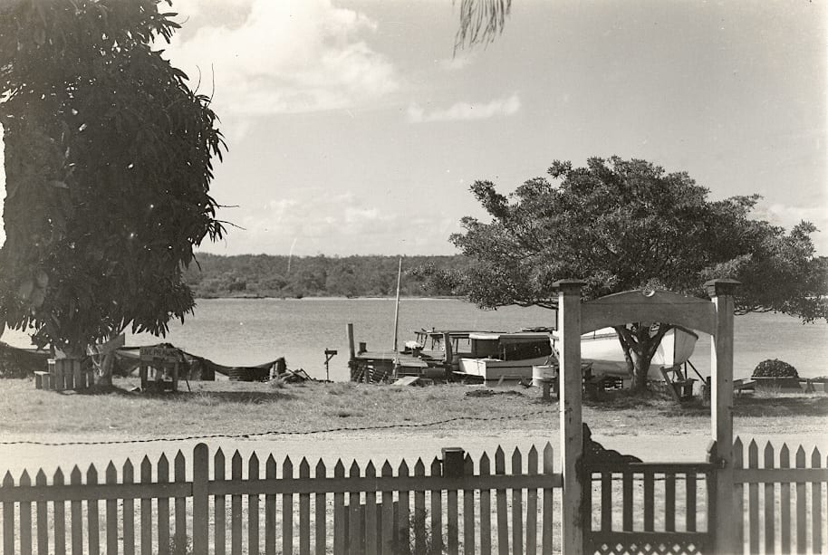
Gympie Terrace, 1952
Residents were outraged when a pelican was painted green in 1952 with many asking for stronger action to protect the (already protected) birds. It was suggested that a visiting film crew were the likely perpetrators.
The Council improved the river frontage by adopting recommendations from a health inspector: removing fishing nets, old boats and other gear from the north shore; and demolishing unsafe wharves, jetties and mooring stakes regarded as a danger to swimming children, including along Gympie Terrace.
Hilton Terrace and Hitlon Esplanade, Lake Doonella, Tewantin, and Goat Island, 1947.
Although the road of Gympie Terrace itself had been surfaced with bitumen, other sections in the neighbourhood remained dirt roads and parts were believed to be dangerous, especially during the heavy traffic of holiday periods. The corner of Gympie Terrace and Weyba Road was one such ‘dust bowl’ section, with residents hounding the Council to hound Main Roads to fix the issue.
The first official meeting of the Noosa Yacht Club was held in 1958 near the corner of Gympie Terrace and Albert Street. A clubhouse was later built on the riverbank in 1961, opened by Chairman of Noosa Shire Council, S. Adams, and the Commodore, W. Hayter.
A meeting of the Noosa Yacht Club on Gympie Terrace, circa 1958. Image courtesy of George Pierce
The 1960s & 1970s
Surf culture surged in the Sixties and Seventies alongside urban development to accommodate more residents and the tourists who now expected more than just a campsite for their holidays.
Noosaville and her neighbours were still relatively isolated. But a high-grade road running along the coast from Sunshine Beach to Maroochydore had been agreed to by the State Government after a strong commitment by the local Member of the Legislative Assembly, David Low. The first stage between Sunshine Beach and Peregian Beach was opened by the Premier, Frank Nicklin, in April 1960. The road was later named after David Low.
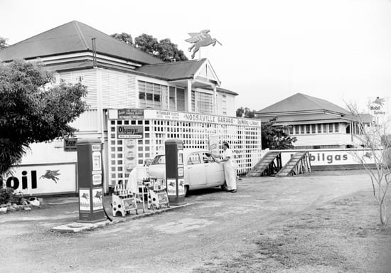
Noosaville Garage, 1955. Image courtesy of Sunshine Coast Libraries
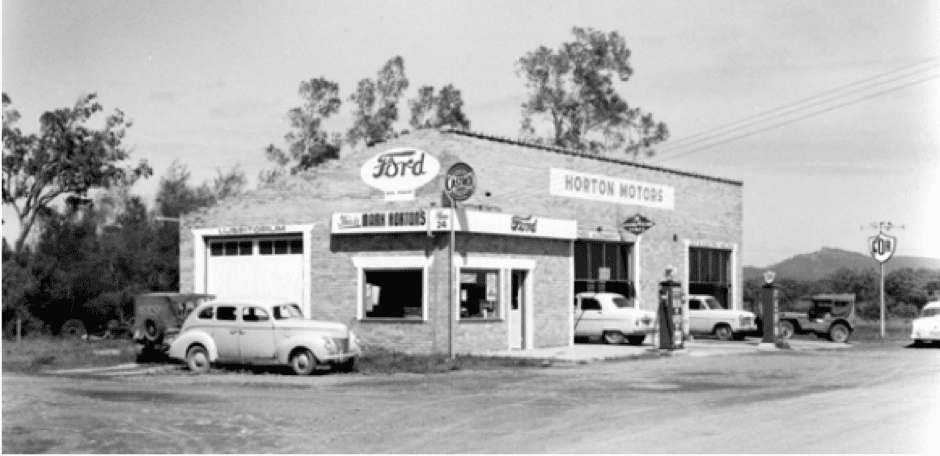
Horton Motors, Hilton Terrace, 1957
Active discussion in 1962 between the Noosa Shire Council and developer T.M. Burke regarding a road around the headland cliffs of Noosa National Park led to the foundation meeting of the Noosa Parks Development Association (later the NPA). The association was successful in thwarting the planned road.
During the 1960s the beach at Noosa Heads featured in surf documentaries and surfing tourism surged. Noosa Heads, still much smaller than Noosaville at the time, began to develop at a greater pace than its neighbouring suburbs, especially regarding hotels and motels. But this increased interest continued to bring visitors and brought further development to Noosaville also.
The Noosa Six Mile Dam (now Lake Macdonald) was officially opened in 1965, providing reticulated water to the towns of Noosa Shire. Prior to this the residents of Noosaville were self-reliant, catching rainwater from their roofs in water tanks.
By 1967 Noosaville had 430 dwellings (compared to 101 in Noosa Heads; 85 at Sunshine Beach; and 32 at Peregian Beach). Many of the new homes and other buildings being built in Noosaville around this time were made with yellow bricks from Cooroy, in contrast to earlier weatherboard dwellings.
Cyclone Dinah flooded southeast Queensland in January 1967, including Noosa. Another flood the following year, in January 1968, was far worse. Apparently, the residents made the most of it, catching mullet in Noosaville’s streets.
Although prawning remained an important industry in the river and lakes into the 1990s, by the end of the 1960s it was already showing signs of overfishing and the industry focus moved out into Laguna Bay and south to Mooloolaba.
Noosaville, 1972
In 1969, construction of concrete bridges over both Lake Doonella and Weyba Creek began to replace the ones opened forty years earlier in 1929. However, the popularity of the old Weyba Bridge saw it remain in place as a pedestrian bridge.
An estimated 4000 vehicles were using the highway from Coolum to Noosa per day in 1970. In December, East-West Airlines flew the first direct flights from Sydney to Maroochydore Airport. This would have an enormous impact on Noosa’s tourism with more hotels and motels being constructed in Noosaville.
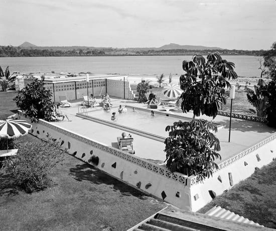
Pool, Lakes Motor Inn, 1971
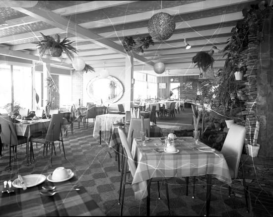
Communal dining room, Lakes Motor Inn, 1971
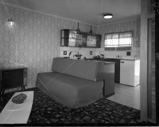
Lounge and kitchen, Lakes Motor Inn, 1971
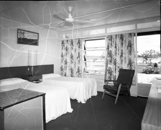
Bedroom, Lakes Motor Inn, 1971
The Queensland Government granted a development lease for Hay’s Island and other islands in 1971, an idea originally mooted by Councillor Edgar Bennett back in 1946 and agreed to by Council in 1964. Dredging began in 1972 followed by the construction of concrete retaining walls and a bridge connecting what was now called Noosa Sound to the Spit near Hastings Street. It was officially opened by Premier Joh Bjelke-Petersen in December 1973. The following year, the Noosa Parade bridge was built from Munna Point to Noosa Sound, with Munna Point bulldozed to baldness for the infrastructure. The urban sprawl was now continuous along the southern bank of the river from Tewantin to Noosaville to Noosa Heads.
The drive-in cinema at Noosaville, 1972
Development of Noosaville moved apace during the 1970s. The Noosa River Shopping Centre opened on the corner of Gympie Terrace and Thomas Street in 1970. Soon after, a drive-in cinema was under construction. In 1973, 153 hectares of non-waterfront land along Hilton Terrace was sold for residential development.
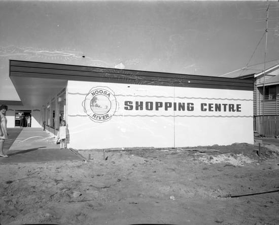
Noosa River Shopping Centre in construction, 1970
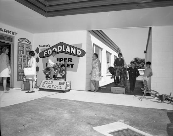
Noosa River Shopping Centre supermarket, 1970
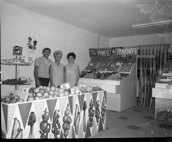
Noosa River Shopping Centre fruit store, 1970
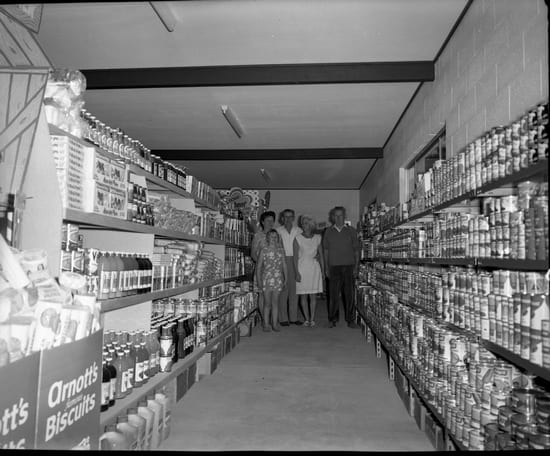
Noosa River Shopping Centre supermarket, 1970
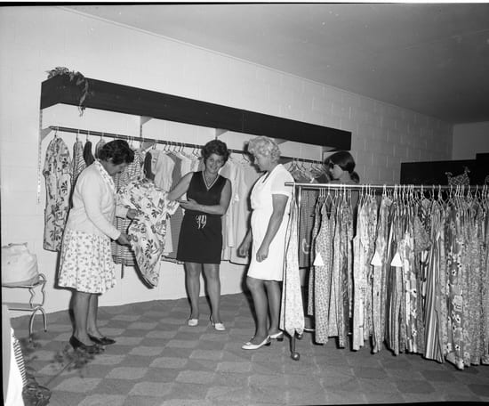
Noosa River Shopping Centre ladies’ store, 1970
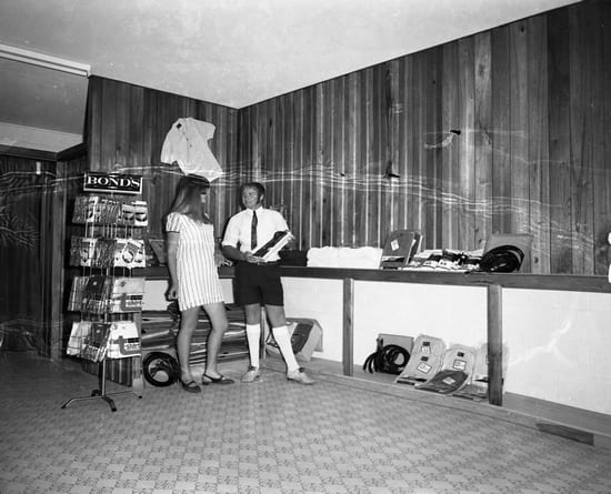
Noosa River Shopping Centre men’s store, 1970
Cyclone Wanda hit Noosa in January 1974 and Cyclone David flooded the area in 1976, with water flowing through the ground floors of many houses and shops along Gympie Terrace.
Community debate began regarding the canal development that is now Noosa Waters, following in-principle approval from Council in 1977.
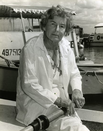
Nancy Cato aboard her boat
In 1979, The Noosa Story: A Study in Unplanned Development by Nancy Cato was published. Cato was an accomplished author who had moved to Noosa. The book acknowledged the traditional owners of the Noosa area, discussed the history and environmental impact of European settlement, and called for limitations on development as well as protections for the environment. It was ridiculed as extreme and unrealistic by many at the time, but for many others it was a wake-up call to preserve what made Noosa special. Cato did not begin the local environmental movement but she became a local icon. The Noosa Parks Association made her a life member. Nancy Cato Park, on the banks of Weyba Creek at Munna Point, is named in her honour.
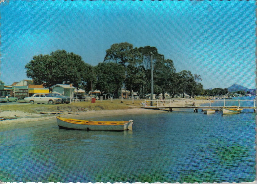
1970s postcard featuring Gympie Terrace
The late 20th Century
Noosaville continued to grow in the late 20th Century as debate between environmental preservation versus development also grew.
From 1976 to 1981 the Shire’s population rose from 10,425 to 17,071. Much of this growth was in Noosa Heads but this meant that a lot of the extra traffic flowed along Gympie Terrace. In 1981 Noosa’s first traffic study identified the need for a Noosaville bypass.
.
Waterskiing display, Festival of the Waters, 1979
An upgrade to the Sunshine Coast Airport in 1984 enabled its use by jet aircraft, with the first Boeing 737 landing in April. A further upgrade in 1993 introduced services direct from Melbourne. Tourism to Noosa increased accordingly.
The population of Noosa Shire reached 20,328 in 1986. Noosa’s first Strategic Plan was gazetted in 1988 and in 1990, buildings higher than four storeys were banned throughout Noosa Shire. Caravanning and camping at Noosa Woods at the mouth of the river was also banned and work began returning the area into a rainforest recreational area. As camping had ceased in Tewantin in 1978, this left Munna Point as the last camping site on the river.
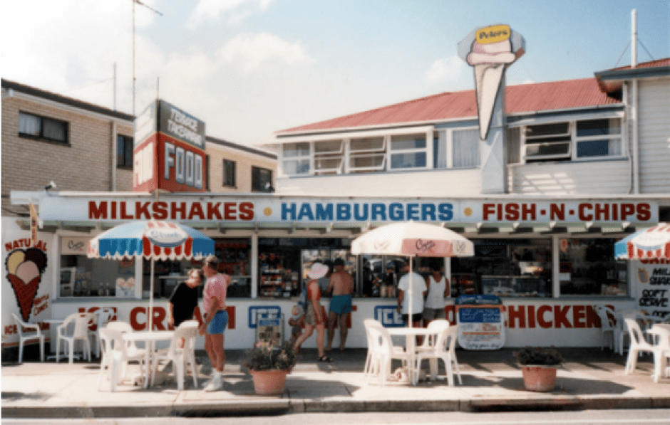
Terrace Takeaway, corner of Gympie Terrace and Edward Street, 1992
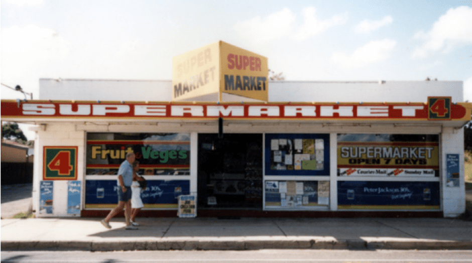
4 Square Supermarket, Noosaville, 1992. Image courtesy of Sunshine Coast Libraries
Sales for land at Noosa Waters finally began in February 1991, with the initial lots at just over $100,000 (around $200,000 today) selling out in less than 2 months. The idea for the canal development had been debated back in 1977, with an impact report accepted by Council in 1986. Construction would include a lock and weir system and two bridges: the James Duke Bridge, named after Noosa Shire Council’s first Chairman, and the William Gibson Bridge on Gibson Road, named after the Gibson family patriarch. Over 10,000 people are believed to have attended the official opening by the Member for Noosa, Bruce Davidson MP, on 20th June 1993. Noosa Waters was voted Best Queensland Development in 1996 and again in 1997. The developer, T.M. Burke, completed the estate of 928 lots in 1999.
Noosa Waters under construction. Image courtesy of David Keep
Noosa Council bought Wallace House for development as a home for arts and crafts in 1992. It was officially opened on 8th June 1993. The 9-hectare Wallace Park complex now comprises the Wallace House Arts and Crafts Centre, Noosaville Library, the Noosa Leisure Centre, the Respite Centre, the Noosa Parks Association Environment Centre, a specially landscaped Aboriginal heritage area, Tewantin-Noosa Meals on Wheels, the Noosa Bridge Club, and an Endeavour Foundation training centre.
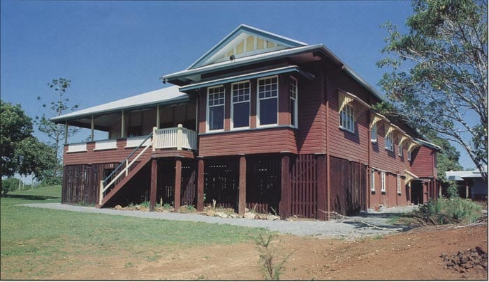
Wallace House, circa 1990
The old Weyba Bridge, retained for recreational fishing and pedestrian traffic, partially collapsed in November 1991 due to vermin infestation. It was dismantled by early 1993. But a group called ‘Friends of the Old Weyba Bridge’ formed to raise funds and a replica was constructed in 1995.
The Council announced a population cap of 56,500 people for Noosa Shire. The plan was not without controversy but it had been calculated by figuring all available land being developed in accordance with the Council’s Planning Scheme. It was the first local government in Australia to do this. (The figure was later extended and the cap currently sits at 61,100 today).
In 1996, water metres were introduced throughout the shire to curb excessive consumption.
A new ferry called Riverlight, named after the Massoud family’s original vessel, began transporting people upon the river from Tewantin to Noosa Heads in December 1998. The 65-seat boat carried 1500 passengers per month in its first year. The ferry service continues today, including three stops along Gympie Terrace.
Noosa Private Hospital opened in Goodchap Street in 1999.
The 21st Century
Despite countless changes to Noosaville over the years, the esplanade of Gympie Terrace retains numerous ties to its past and continues to recognize and celebrate its heritage.
The 2001 census recorded Noosaville’s population at 6,808. The population of Noosa Shire was estimated to be 46,000.
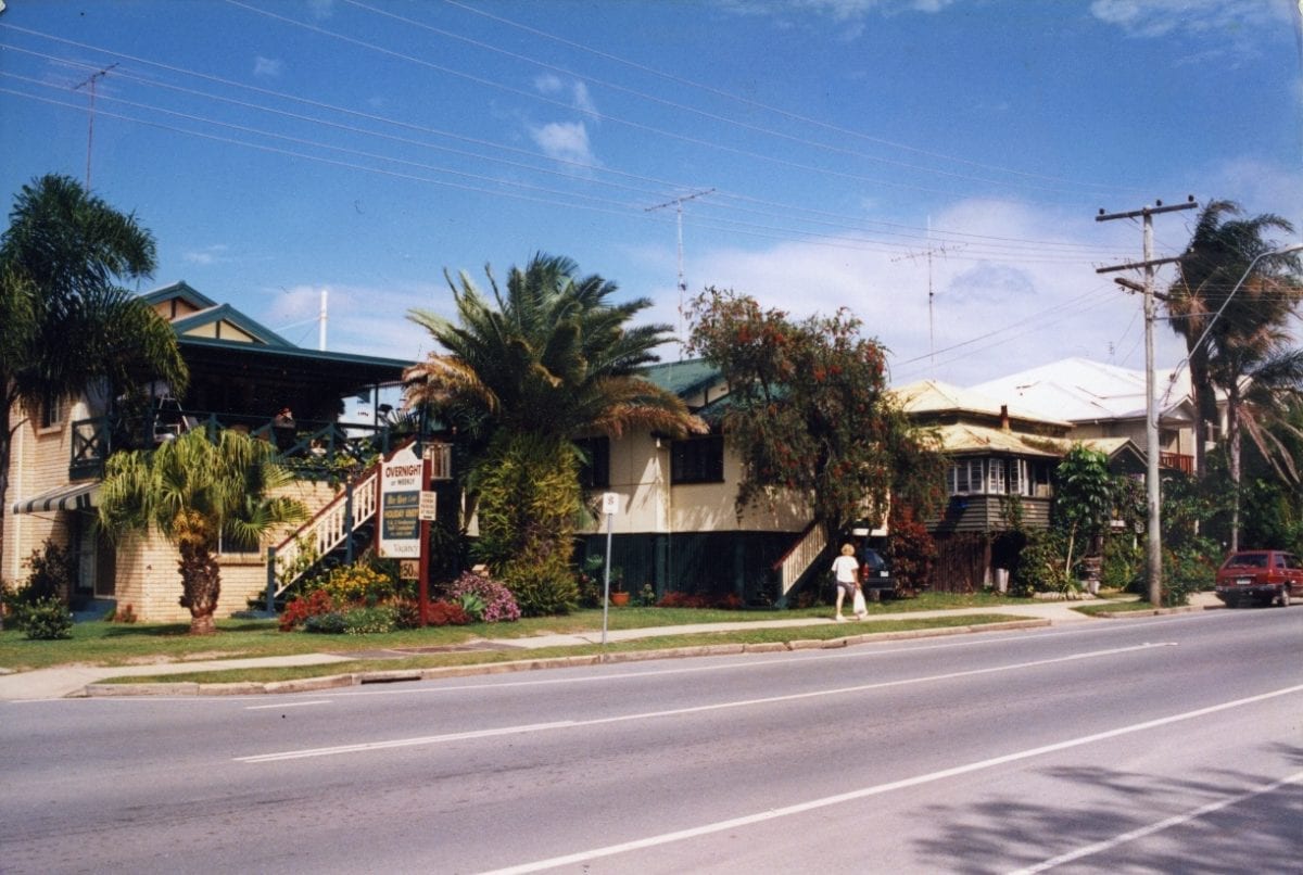
Noosaville, early 21st Century. Image courtesy of David Keep
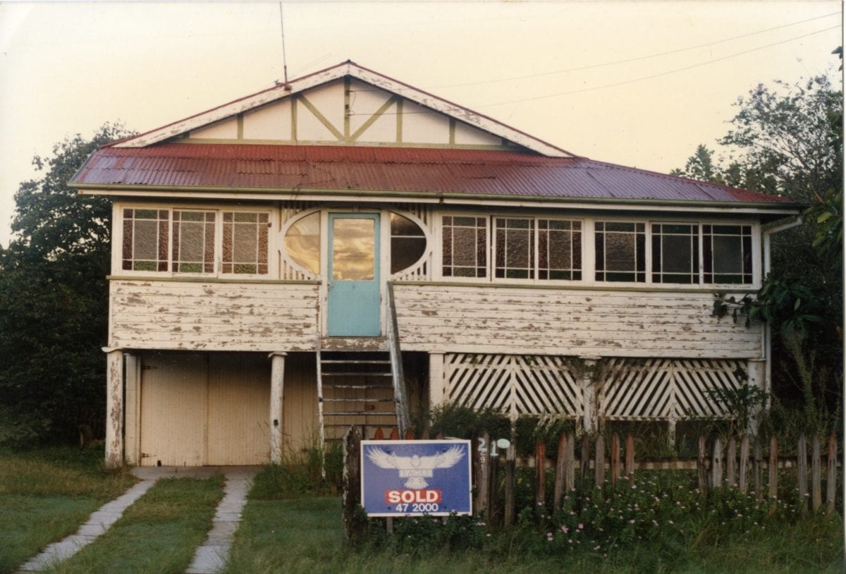
A great example of a Noosaville Queenslander, early 21st Century. Image courtesy of David Keep
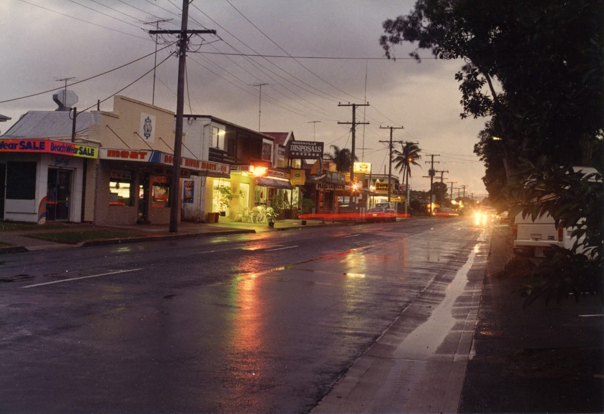
Gympie Terrace, early 21st Century. Image courtesy of David Keep
The award-winning Noosaville Foreshore Upgrade commenced in 2001 at a cost of $2.2 million. In 2004 the Noosa River Plan was developed in conjunction with the community and was endorsed by the State Government the following year.
A long drought at the beginning of the 21st Century was broken in 2003 by the formation of tropical cyclone Erica to the north.
The Shire of Noosa was merged with the Shire of Maroochy and the City of Caloundra on 15th March 2008, following the Local Government (Reform Implementation) Act 2007. A local referendum in Noosa Shire had been held by the Australian Electoral Commission, with 95% of the voters rejecting the amalgamation but to no avail. Noosa’s mayor, Bob Abbot, won the vote for the mayoralty of the new Sunshine Coast Council.
The last remaining camping site on the Noosa River, the Noosa River Holiday Park at Munna Point, was added to the State Heritage Register in 2009.
In 2009, the executive committee of the Noosaville Association floated the idea of changing the name of Gympie Terrace, suggesting that its history was in the past, that it caused confusion to tourists, and that property prices would increase by removing the association with the former gold-mining town that was no longer flourishing. The proposal outraged families with long ties to the street (as well as historians).
Following a change of the State Government, a vote in 2013 to de-amalgamate Noosa from the Sunshine Coast Council returned a positive return of 81%. The Shire of Noosa was re-established on 1st January 2014.
The Council began public consultation to update the Noosa River Plan in 2017.
.
Gympie Terrace, 2019